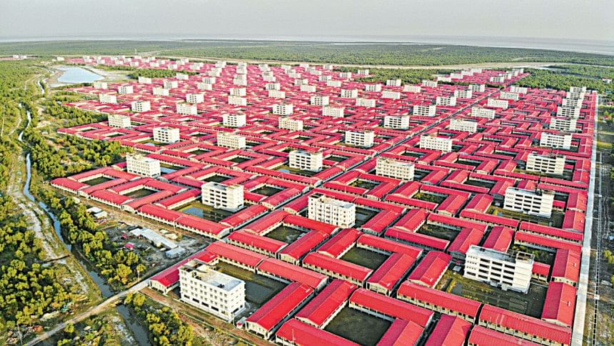
Bhasan Char ready for Yaas

After a day of heat at Bhasan Char yesterday, the winds began to pick up towards the evening and there was some rain.
This is the first time after Rohingyas were resettled there that Bhasan Char would see a cyclone in the Bay.
Although the storm was far away yesterday, the authorities at Bhasan Char were taking no chances and were adhering to their standard operating procedures to ensure the safety and wellbeing of the refugees.
"We have already started making people aware of the cyclone. All the shelter centres are ready," Commodore Rashed Sattar, project director of Ashrayan-3 Project, popularly known as the Bhasan Char project, told The Daily Star.
The PD said various law enforcement agencies, volunteers and Rohingya representatives were working together to this end.
He said they have already started campaigning and were hopeful of evacuating the Rohingyas from their households if required.
They have opened an operation coordination centre from where they would look for problems in the evacuation and sheltering process, he said, adding that adequate medicines and additional medical manpower was deployed. An operation theatre was set up too.
Commodore Rashed said special measures were taken to protect the warehouses and oil tankers.
"We are continuously monitoring the cyclone situation and devising the strategy according to that," he said.
Dry food, candles, and other necessary items were kept ready and would be distributed if the Rohingyas were taken to the cyclone shelters.
The Bangladesh government had spent around Tk 3,100 crore in developing the island, building infrastructure and putting in place a protection system against extreme climate events under the project delegated to the Bangladesh Navy.
About two hours by boat from Noakhali town, Bhasan Char is slightly southwest of Sandwip in the Bay of Bengal, close to the mouth of the Meghna river.
A number of development and international organisations questioned its safety and protection from natural disasters when Bangladesh decided to relocate the Rohingyas refugees there.
Project officials said the embankment had been constructed after studying data of the last 176 years.
The outermost line of defence is the "Screen Break Water", a 2.5km long string of pillars in the sea to break strong currents and waves. This is followed by gravels and geo bags.
Then there is almost a half-kilometre-thick layer of planted mangroves that leads to the main nine-feet-high, 12-km embankment of the island.
Construction work was ongoing to raise the height of the embankment to 19 feet.
The south and northwestern side of the embankment is protected by natural mangroves.
According to information provided by project officials, waves surged up to 4-5 feet high during cyclones Fani, Bulbul, and Amphan.
Each of the 120 cyclone shelters were built on plinths 12 feet above the ground and could hold 1,000 people and 200 cattle heads.

 For all latest news, follow The Daily Star's Google News channel.


Comments