


Linking Bhola with Barishal: Japanese firm to build bridge


A Japanese company is likely to build a bridge over the Tentulia and Kalabadar rivers to connect island district Bhola with Barishal under a Public Private Partnership (PPP) initiative.
A proposal to build the 4.68-kilometre bridge with a 4.9km elevated road -- the entire construction totalling nearly 10km -- by Miyagawa Construction Ltd was placed before the Cabinet Committee on Economic Affairs on Wednesday for its approval in principle.
The committee, led by Finance Minister AHM Mustafa Kamal, neither approved nor rejected the proposal tabled by Bangladesh Bridge Authority (BBA).
"We have sent back the proposal to clarify some points and hope to give approval in the next meeting," Kamal told reporters after the meeting.
Belayet Hossain, executive director of BBA, said they would submit the proposal again with all the necessary papers before the next meeting.
An official of PPP Authority said they would place the project before the next meeting of Bangladesh-Japan Joint PPP Platform. The Japanese authorities concerned would then scrutinise the proposal of Miyagawa Construction Ltd.
If the Japanese authorities give the go-ahead, the Bangladeshi government would then make the final decision about engaging Miyagawa in the project, the official, wishing not be named, said.
Once built, the bridge in the country's southern part will shorten travel time between the two districts and facilitate gas supply from Bhola, said officials.
THE BHOLA BRIDGE
BBA has completed the feasibility study in August last year, which selected possible alignment of the bridge, officials said. The cost was estimated at Tk 9,922 crore, which may escalate after the detailed design is finalised, they added
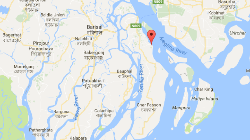
Based on survey, study and discussions, the bridge alignment was fixed at about a few hundred metres downstream from the Bheduria Ferry Ghat on the Bhola side and the Laaharhat Ferry Ghat on the Barishal mainland side. It will also be downstream from the existing highway, which connects to the ferry terminals.
According to the study, the length of the bridge would be nearly 10km, 3km of which would be over Sreepur Char, which separates the two channels of the braided river.
BBA Chief Engineer Quazi Muhammad Ferdous said initially it was thought there would be a single bridge but as there was land, they have proposed that the construction would be a 4.68 kilometer bridge and a 4.9km elevated road.
Separated by the Tentulia river, Bhola is on the eastern part of the Barishal division. With an area of 3,400sqkm and population of over 20.37 lakh, the district does not have any direct road link to Barishal.
By river, one can go to Bhola's Bheduria from Barishal by launch in two hours or in 40 minutes by speedboat. One has to travel around 30 minutes on road to reach Bhola Sadar upazila from Bheduria.
From Laaharhat Ferry Ghat in Barishal, one can also reach Bheduria by launch. There is also a ferry running between the terminal and Ilshaghat of Bhola Sadar.
Passenger and goods transportation from Bhola rely on boats and launches and it was affecting the district's socio-economic development, according to the study.
"Completion of this project will bring enormous social and economic benefits to the people living in Bhola in particular and the southern part of the country in general," reads the study.
The study projected that the traffic volume (motorised traffic per day) through the bridge would be 6,990 in 2024; 15,620 in 2034 and 56,701 in 2054.
 For all latest news, follow The Daily Star's Google News channel.
Comments