

Navigating Dhaka by bus with Google Maps

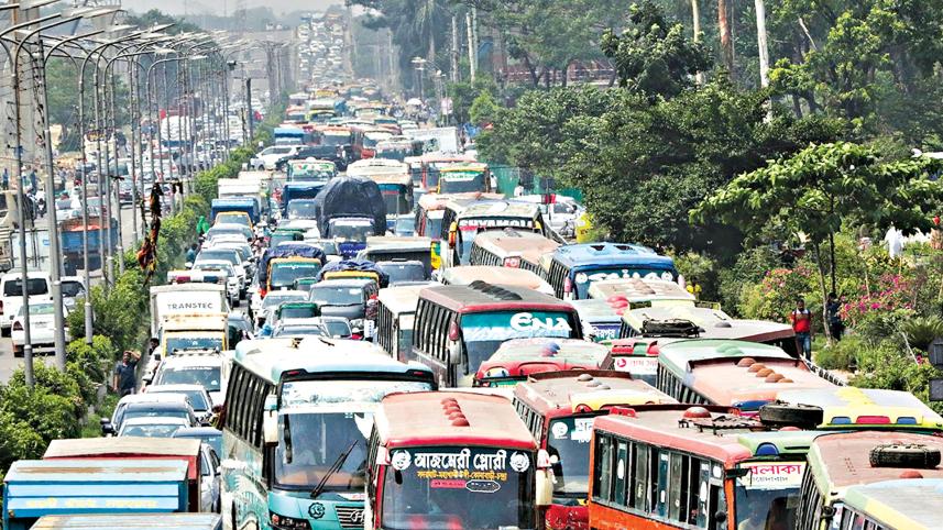
Dhaka is not a big city, but it is not an organised city either. Old Dhaka was fondly called 'Bayanno Bajar Teppanno Goli'r Shohor' (a city of 52 bazaars and 53 lanes) by many, and many parts of new Dhaka can also be confusing to commute for the uninitiated.
But like most aspects of life, technology has also made finding one's way around easier, with services like Google Maps, that gives you reliable walking and driving directions, including a live update of traffic conditions. However, for those willing or requiring to use public transport, Maps was not all that helpful at least in Dhaka... until recently.
With the introduction of bus routes for the capital on Google Maps in December, commutes on public transport should get a little less confusing. However, with so many routes and different buses to go along with them, it is worth wondering how useful the new feature is.
To test it out, this correspondent decided to ride the bus for multiple destinations in a day, using Google Maps. With the start point being Banasree, the destinations were Uttara, Mirpur, Shyamoli, Kalabagan, Farmgate and back to Banasree.
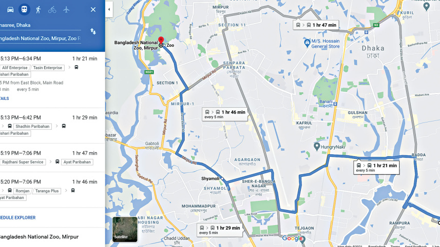
After going to Maps' public transport menu, selecting the start point and destination shows multiple options. Each option takes a different route to reach the same destination, and shows all buses that ply on the route.
Right here, the biggest issue when it comes to using public transport is resolved. It is a daunting task to know and remember all the routes and buses for a specific destination, but now, Maps can do all that for you.
The top option is shown as the recommended route. However, that is not always the best way to get to the location. The app seemed like it calculated the recommended one based on the least time required. On the surface this might seem appealing, but the journey may be broken into different sections, which means the commuter has to take the hassle of changing buses. So, even if other options on the list may take more time, they might be worth looking through.
When it comes to accuracy of information, Maps does fairly well. Names of all the buses are exactly what they are supposed to be. Estimated time, on the other hand, is not that reliable, but that is a given when Dhaka's unpredictable traffic is considered.
The route maps were mostly spot on, but still, there were some discrepancies. While going from Uttara to Mirpur, all options showed that one had to shift buses. But a bus, Paristhan Paribahan, goes there directly. Sometimes, Maps directs the commuter to walk long distances to board buses. It basically tries to be an ideal citizen and use bus stops, sometimes "invisible ones", when showing routes. Therefore, whether one needs to actually walk can be based on personal knowledge and discretion.
While going from Farmgate to Banasree, this correspondent encountered another problem. Maps might not show all options for a destination. The bus Shadhin Paribahan plies this route, but Maps did not list it, and showed other, much more convoluted, options. This might have been an isolated incident, or Maps thought the bus stopped its service, since it was past 10pm.
Maps is, overall, a great tool to manoeuvre through Dhaka's public transport. It might not be perfect in all aspects and every single time, but it provides all that is needed for one to use buses more often.
 For all latest news, follow The Daily Star's Google News channel.
Comments