


What would make Dhaka a good city?

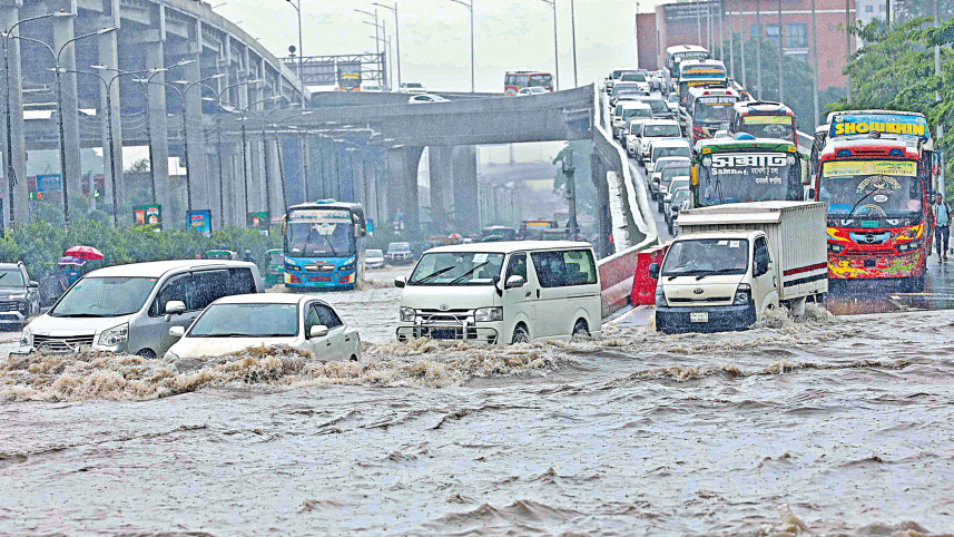
There we go again – the shaming of Dhaka as 171st, the third worst, in the liveability index of 173 cities around the world. And then follows the usual: a general indignation at being ranked below bombarded Kyiv and sectarian Karachi; scepticism about Euro-American measures of our lives; immediate newspaper editorials and op-eds citing what went wrong; and subsequent write-ups such as, perhaps, the one you are reading now.
Meanwhile, planners and policymakers, the city corporations and the unnayon katripokkhos, those who manage the fate of the city, remain steadfast in their silence on why Dhaka remains far from being either a liveable or a good city.

At a recent public conversation on architecture and the city, in which I participated, the moderator asked a very pertinent question: “What is a good city?” The responses are, of course, diverse.
While the city may be humanity’s most unique creation on earth, we still struggle to understand its nature and where we want to go with it. In creating a functional modern city, we speak of providing basic urban services, such as a reliable water supply, a sewage system, adequate healthcare, successful transport systems, and so on. In humanistic and democratic terms, we speak of the right to the city, including equal access to the public realm and equitable participation in the city’s resources. How people live together, or not, that is, how they acquire housing and form communities, remains a key benchmark of a good, humane city.
The most evident measure of a good city is the quality of urban life provided through public spaces and amenities – how people navigate and experience the commons. Many have written about the sorry state of our public spaces: either they do not exist, or whatever does exist is in a degraded condition or has become an object of privatisation.
Claiming that walkability is the sign of civility in a city, I have argued that the state of our footpaths indicates how we regard public life on the street. In most cases, footpaths do not exist in Dhaka, and where they do, they are interrupted by broken tiles, police boxes, vendors, construction materials, or are often so high that you would need a ladder to climb onto one (in some places in Dhaka, a footpath is three feet high!).
However, in that conversation on what makes a good city, my immediate response was that a good city is one that maintains an ecological balance with its natural assets and resources. I had Dhaka on my mind, and, quite coincidentally, this was at a time when Dhaka, Chittagong and other cities were being drowned by the monsoon rains. While the term “ecology”, like sustainability and resilience, is becoming clichéd, it still retains the capacity to speak about an integrated world under threat.
A 30-minute drive outside Dhaka still reveals the reality of an integrated landscape. Rivers, canals, waterways, ponds, floodplains and agricultural fields completely girdle the city in what I see as a terraqueous mesh. Few people recognise that Dhaka is a fragile landmass, virtually an island framed by five rivers and intersected by a fluid landscape. This is the gift of the delta.
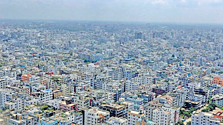
But consider the planning and development practices that have defined Dhaka over the last 50 years or so. Furious landfilling operations, driven by the real estate economy, infrastructural interventions and development planning, have brutalised the integrated landscape beyond redemption. Whether planned by the state or engineered by large private developers, the city has advanced by ruthlessly filling vast swathes of wetlands and floodplains in order to prepare plots and properties. What hides behind the discourse of conventional planning is the production of dry land and the extraction of profit. The outcome is the erasure of water. In other words, our cities are being built on a prejudice in favour of dry land.
Conventional planning views the city from a high and dry vantage point. I call this a “dry ideology”, in which the city is considered developed if it is dry, and primitive and backward when wetness prevails. Reading the flurry of write-ups on flooded cities published at this time, I think we have reached a broad consensus that conventional planning and engineering have failed miserably to give us a good city. It is planning itself – faulty, outdated and prejudiced – that has brought disaster to Dhaka. It has failed to grasp the enormity of a city that now has the second-largest population in the world, embedded in the planet’s most dynamic delta.
What now? I have long argued for an alternative imagination for planning around land and water, rather than land versus water. In this incredibly fluctuating landscape of land and water called the Bengal Delta, where water rises and falls, comes and goes, flows and overflows, falls and soaks, and constantly shifts the boundaries between settlement and waterscape, a new urban imagination is required.
The question of water is not simply about dealing with water-clogged streets during the monsoon, but about working out how the city should work with water in its fundamental structural and organisational sense. Unless we see this as a philosophy of city-making, no matter what measures city authorities and their consultants take, we will continue to experience a Chittagong washout and a Dhaka deluge every time it rains.
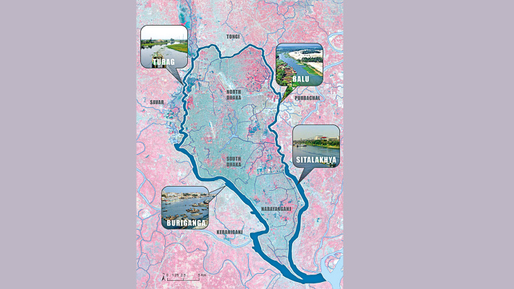
A new way of thinking should usher in a conception of the city that integrates urbanism and waterscape. In such a plan, hydrological dynamics should serve as the starting point and framework for city planning and design interventions, in which it should be possible to “bring the city into the floodplain and the floodplain into the city.”
Consider a part of planned Purbachal and the neighbouring landscape that still retains the older water-corrugated form. The clash is vivid: a hard, impervious and abstract grid form on one side, and an undulating landform and valleys on the other. We should think of a third form that retains the incredible landscape corrugation, in which only higher ground receives dense, contiguous development, while lower-lying areas are reserved for the flow of water. By flow I mean both the movement of overflow water from rivers and stormwater from the city.
Flow should be the basis of all urban plans in the delta. Such planning should begin from a wider regional context, grounded in a deep, data-driven understanding of how water gathers and flows. The basic premise is that a river constitutes a vast ecosystem, even when it engages a city or town, and that rivers are conditions of water flow. In fact, the flow and overflow behaviour of a river constitute a “water basin” over a large area in which the city or town is embedded. Such water flow is part of an interconnected water-basin system, from river and canal flow to urban drainage and water supply, and from floodplain ecology to aquifer recharge.
While rivers and their banks are crucial to the management of overflow, canals play a critical role in receiving and draining monsoon rainfall. Wetlands and ponds have the capacity to receive and absorb excess water. The sooner we recover the city’s canals and wetlands from both encroachment and abuse, the greater the chances of recovering from floods.
Rivers are critical not only as ecological lifelines but also as natural settings for an enriched public realm in the form of riverbanks and river belts. The ecological spine and public space intersect at the riverbanks. The same is true of canals and other forms of water bodies, such as wetlands. In a city devoid of planned public spaces, developing riverbanks as generous public spaces should be our unconditional priority. The entire stretch of an urban riverbank should be declared public realm and then developed as open public spaces with parks, vegetation and public facilities. Riverbanks are also prime sites for urban forests. A river is not only a blue line; it is also a green corridor.
In a city like Dhaka, surrounded by a rich terraqueous landscape, as noted earlier, there is a constant battle between the ecological obligation to preserve the floodplains and the opposing economic pressure for invasive and aggressive development. A third form should be pursued that mediates between a critical ecology and relentless development. The third form is a new urban imagery with buildings of a special architectural typology and high density.
To safeguard wetlands and similar water bodies, we can imagine dedicated peripheral building rings along the demarcated edge of wetlands that are to be conserved as a “sponge” for deflecting floods, helping with aquifer recharge, and advancing aquatic biodiversity. Wetland parks can be carefully planned as an active public realm.
What makes a good city, then? In the delta, a good city is one that befriends water, thrives with the rhythm of rivers, and welcomes their flux and flow. It’s a place where, at the first drop of rain, we don’t bring out our pens to castigate, but to celebrate.
 For all latest news, follow The Daily Star's Google News channel.
 Kazi Khaleed Ashraf is an architect and writer, and directs the Bengal Institute for Architecture, Landscapes and Settlements.



Comments